Click on your picture in the top right corner, go to Preferences and select your notification preferences.
How to create a static point for measuring

Hello,
In my river case study I would like to measure water levels at one specific point. I would like to compare water levels at different discharge scenarios and I need to calibrate these water levels based on measured points. With the measuring tool I can measure the water level at a selected point. However, if I want to compare again at that same point I need to click again (which results that my measurement point is shifted. This increases bias in my calibration strategy and analysis.
I was wondering if there is an option to create a static measurement point, so I can compare the water levels at excectly the same location?
Regards,
Raymond
Best Answer
-
Correction on my previous post: it is possible to save the location you measured!
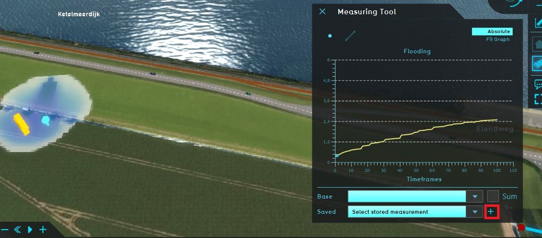
When you click on a location to measure, you can save this measurement by clicking on the plus sign.
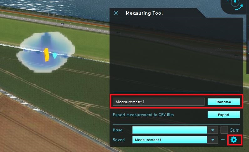
You can also rename the measurement by clicking on the wheel icon.
In the Saved drop down menu you can choose your saved measurement. Switching between overlays will show measured values on the same point. In this way it is possible to measure and compare water levels on exactly the same point.
Tygron support team

Answers
Hi @Vechtstromen RvR,
It is not yet possible to save the location you measured with the measuring tool. I will add this as a feature request.
Maybe as a workaround you can export the water levels as a GeoTIFF and use a GIS to measure on the same location.
Tygron support team