The Tygron Community Forum will be discontinued on March 6th 2026, matching the release of the 2026 version of the Tygron Platform.
Click on your picture in the top right corner, go to Preferences and select your notification preferences.
Please keep in mind:
1. To only comment on the topic where the discussion is about. Do you have a new question or topic? Please start a new discussion.
2. Be kind to other users!
Problem with importing tree data for accurate heat stress map

Hi all,
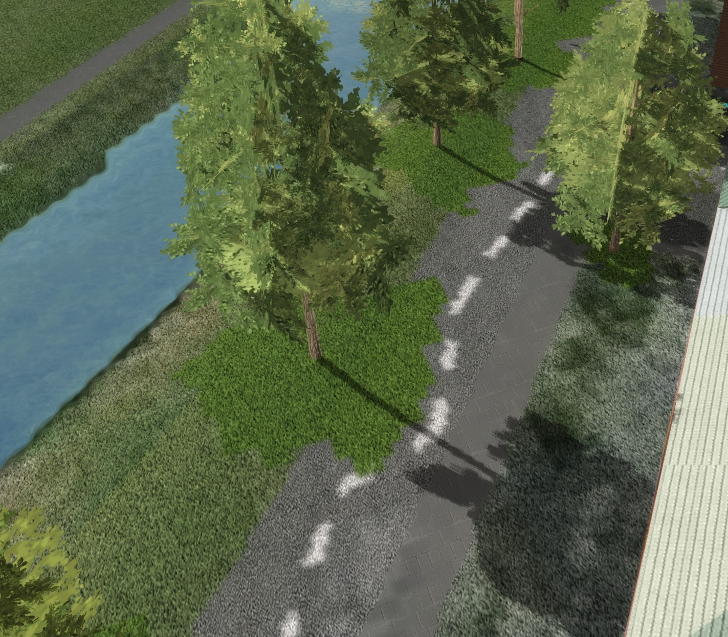
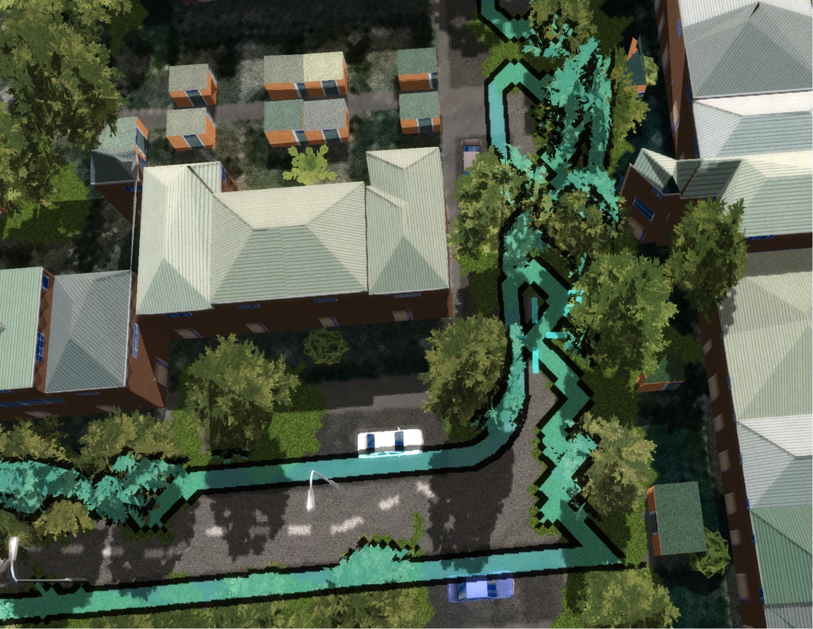
I've been using the Tygron software to create a heat stress map for my graduation project. For the heat stress map to be more accurate, I added data on the current situation for the trees received from boomregister.nl.
First, I deleted all the trees in the project and then imported the data through a GEOJson file. All of this worked out perfectly, and I could use the heat stress calculations for my results. However, while importing the GEOJson file the base map got changed. This is because the canopy of the trees is projected on the ground of the base map, and the roads go around this area (see pictures).
Is there a way for the base map to be unchanged when the tree data is added?
Thank you in advance!
Kind regards, Mika van Dijk
Comments
Hi Mika,
What you're running into is the fact that one of the restrictions for buildings is that there can be at most 1 Building in any location. If your dataset defines a different Building in a specific location, it will overwrite whatever is there. As the dataset you're using consists of rather large polygons, the import of these polygons is also taken at face-value by the software: your dataset dictates those large locations should be trees (or plots of trees), and as such the existing buildings are cut out to make room for them.
Currently, the Geo Import Wizard can load in polygon data, or point data which is automatically buffered. For trees, we recommend using a point-dataset which can then be minimally buffered automatically by the geo import wizard.
Although the wizard doesn't offer the option out-of-the-box, it ís possible to leverage the Geo Plugin functionality which can be configured to automatically reduce polygons to point while importing. Some instructions on how to set up a geoplugin for this can be found as part of our GeoPlugin tutorial: https://previewsupport.tygron.com/wiki/Geo_Plugins_tutorial#Geo_Plugin_modifying_data
You can then, in the geo import wizard during the Function Mapping step, opt to use the geo plugin to import the tree data.
Because you indicate you wish to use this data for heat calculations, I also want to indicate the alternative option of loading in the foliage canopies as Areas. This will place the data in a different layer than the Buildings and as such doesnt cut them out. You can then configure a heat overlay, using its configuration wizard, to refer to Areas for its foliage rather than tree functions.
Regards!
Rudolf
Sprawling spreadsheets so intricate Alexander the Great cuts them in half.