The Tygron Community Forum will be discontinued on March 6th 2026, matching the release of the 2026 version of the Tygron Platform.
Click on your picture in the top right corner, go to Preferences and select your notification preferences.
Please keep in mind:
1. To only comment on the topic where the discussion is about. Do you have a new question or topic? Please start a new discussion.
2. Be kind to other users!
Interpreting the value of a Ground last value from the water module
Hi all,
I am trying to calculate drought through the water module. The drougth is simulated to set the rainfall 0mm over a period. For the drought calculation I want the sagging through calculating the difference of the ground last value over ten timeframes.
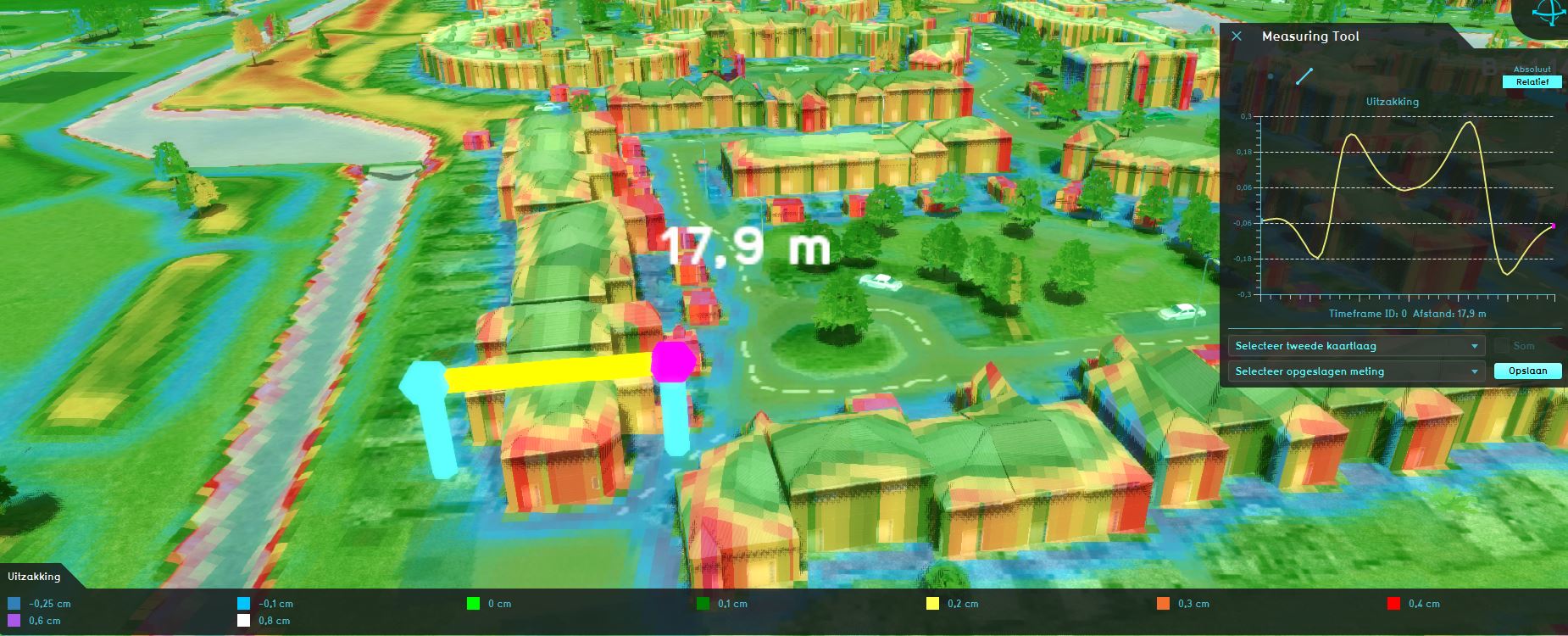
Some results are a bit strange, namely the sagging close by buildings and waterways are not as expected (see the picture). The Ground last value is increasing and decreasing around these points.
In the picture is shown a simulation of a 60 days droughtperiod.
Is this a good/valid method? And what is going wrong?
If you have other ideas, let me know!
Kind regards,
Roy Pontman


Comments
Hi Roy,
groundwater can be rather complex to model and debug properly, due to the many factors which go into an underground water calculations. Any of the following may affect the results presented:
It is also very important to properly consider how much time you wish to give to the groundwater system to settle into a stable situation where possible. And with that also how much time the groundwater has to interact with the surface water system.
As a general rule of thumb, I want to advice that you look into explicitly loading in a water situation which is as close to expected/correct as possible, and then have that water settle over a long period of time with a matching amount of timeframes. This should provide more insight into the behavior of the water , and what kinds of effects can be expected near constructions ans shoreline-slopes.
Regards!
Sprawling spreadsheets so intricate Alexander the Great cuts them in half.