The Tygron Community Forum will be discontinued on March 6th 2026, matching the release of the 2026 version of the Tygron Platform.
Click on your picture in the top right corner, go to Preferences and select your notification preferences.
Please keep in mind:
1. To only comment on the topic where the discussion is about. Do you have a new question or topic? Please start a new discussion.
2. Be kind to other users!
Impacted Buildings Results type

Dear Tygron forum,
We've been experimenting with the Impacted Buildings Results type in the Water Overlays. We found some interesting results that I cannot explain.
As explained in the wiki, the impacted buildings type is determined by the overlay attributes: "Impact flood threshold and the "impact range". As I understand it, these two attributes determine the threshold for buildings to be categorized as "impacted".
So, in this case I used the impact flood threshold of 0,1m and an impact range of 3m. I would expect buildings to be impacted in Tygron when the water level on- or next to the building is higher than 10cm.
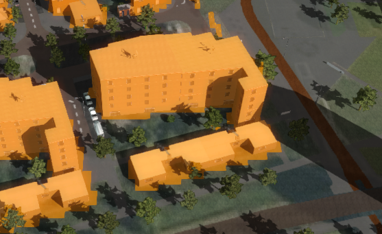
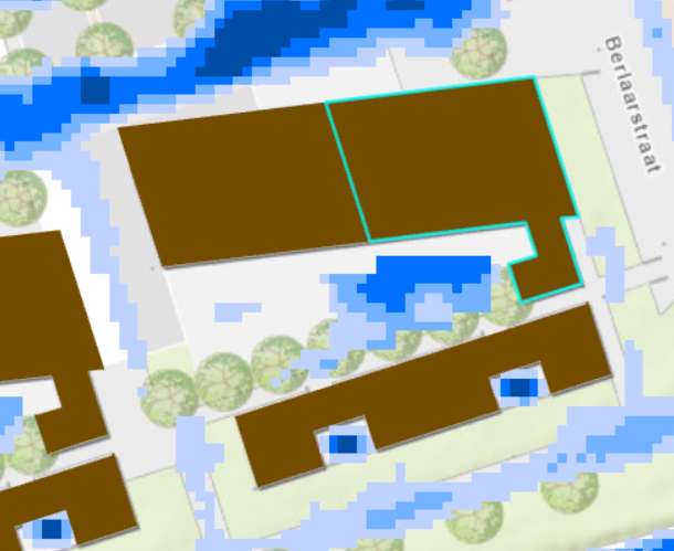
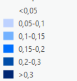
In my results however, I find a building (figure 1) that is impacted, but does not have water levels higher than 5cm close to the building (figure 2; legend in figure 3).
I have encountered this in other projects as well and it results in an overestimation of impacted buildings (if I'm not wrong off course)
Could you help me with an explanation for this observation?
Kind regards,
Glenn Morvan
Comments
Hello @Glenn Morvan ,
Impact is derived not only from the grid cells the construction is on, but also the adjacent cells. This might be the reason buildings show as impacted with a lower-then-threshold value on the buildings themselves. Is this what you see in your project?
https://support.tygron.com/wiki/Impactedbuildingsresult_type_(Water_Overlay)
Best, Vincent
Dear Vincent,
Thanks for your response. However, there is no water >5cm on the construction itself either. This time a figure with the water depth layer on top of the construction:
Hi @Glenn Morvan ,
What type of water layer is being shown? The impacted building layer is based on the maximum water value, so a last value water layer can show something different then the actual impact of a water level peak.
Also. what is the grid size in your project? Can you make the grid one step smaller by any chance?
Best regards, Vincent
Hi Vincent,
Thanks, this explains a lot.
Indeed, with the maximum water value layer, there are three points with deeper water (>50cm) on/near the building. Strange thing is that I can't find big elevation differences in neither the DTM or DSM that could explain water depths of >50cm.
Perhaps this relates to another discussion I started recently (https://community.tygron.com/forum/index.php?p=/discussion/485/pixels-with-high-water-depth#latest)? The situation looks similar to the other case, where pixels with extremely high water depth ware found in between higher constructions.
Curious to hear what your conclusion is. Please let me know if I can provide more information.
Kind regards,
Glenn
Below figures: