The Tygron Community Forum will be discontinued on March 6th 2026, matching the release of the 2026 version of the Tygron Platform.
Receive email notifications by changing your settings.
Click on your picture in the top right corner, go to Preferences and select your notification preferences.
Click on your picture in the top right corner, go to Preferences and select your notification preferences.
Thank you for contributing to our forum!
Please keep in mind:
1. To only comment on the topic where the discussion is about. Do you have a new question or topic? Please start a new discussion.
2. Be kind to other users!
Please keep in mind:
1. To only comment on the topic where the discussion is about. Do you have a new question or topic? Please start a new discussion.
2. Be kind to other users!
Drainage construction raises surface elevation

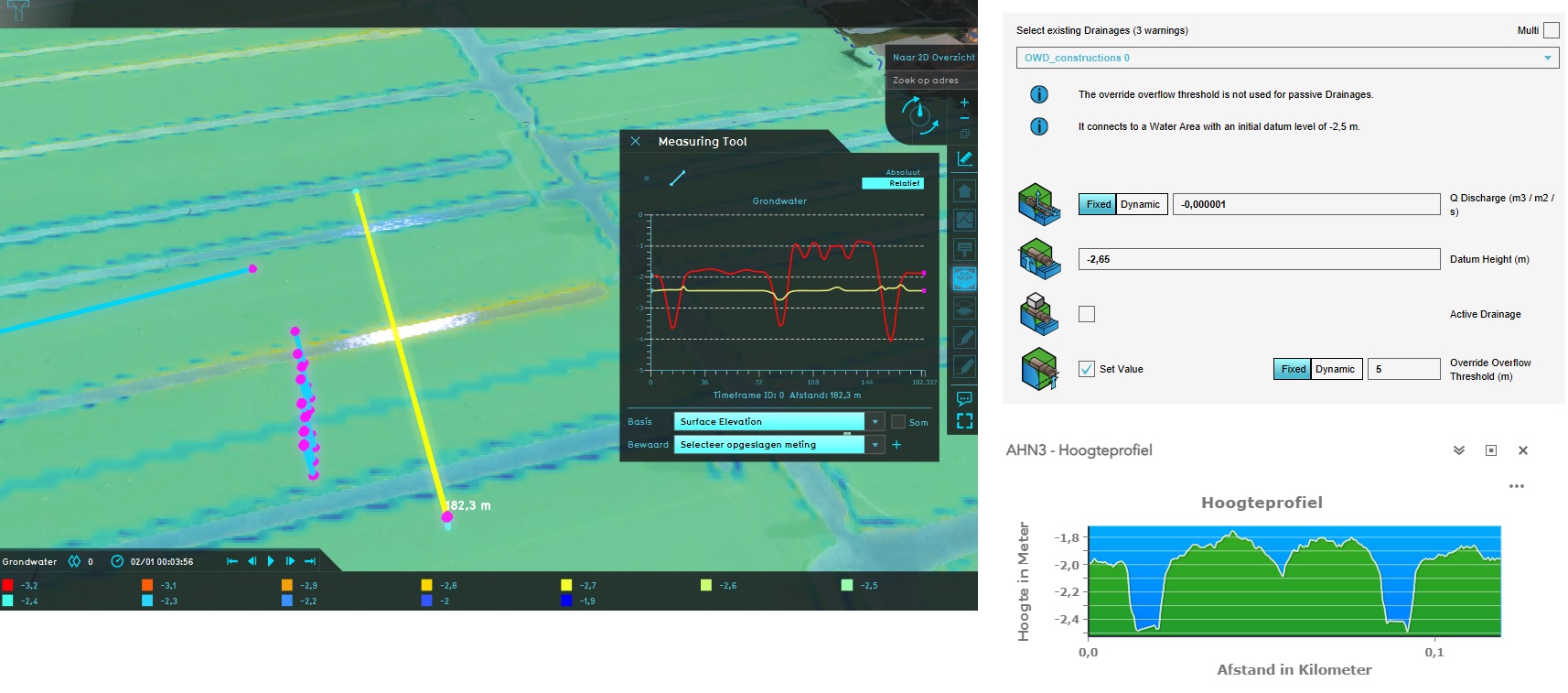
I have imported lineshaped drainage constructions from a Geojson into my project. The drainage constructions are recognized by the Watermodule Overlay. After recalculating the overlay the surface elevation within the area with drainage constructions has been raised +1m.
What could be the cause of this?
Tagged:
Comments
Hello @Harm HDSR ,
Thank you for sharing your question with our community members!
The linear drains have the function: Other function. This causes the ground level elevation. These drains should also have the function Underground drainage construction, just like the drainage plot. It is best to load the data via the (ground)water wizard, because then the works of art are immediately assigned the correct function.
If you adjust this, it should work as desired.
Kind regards,
Hansje
Tygron support team