The Tygron Community Forum will be discontinued on March 6th 2026, matching the release of the 2026 version of the Tygron Platform.
Click on your picture in the top right corner, go to Preferences and select your notification preferences.
Please keep in mind:
1. To only comment on the topic where the discussion is about. Do you have a new question or topic? Please start a new discussion.
2. Be kind to other users!
Use the Surface elevation map to see the heights used for the Water module calculations

In the Platform the Heightmap Overlay shows either the terrain height or surface height.
However, if you are interested in the heights directly used for the water module calculations, use the Surface elevation result type. The heights in this result type may differ from the Heightmap Overlay. For example when creating a breach, the breach height is visible in the Surface elevation result type.
For more information see: https://support.tygron.com/wiki/Surface_elevation_result_type_(Water_Overlay)

Heigtmap Overlay (Digital Terrain Model). The breach height is not visible
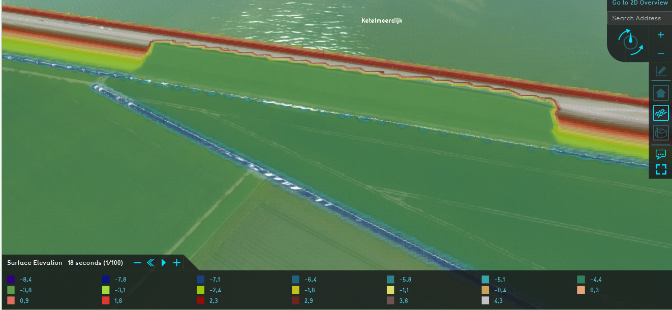
Surface elevation result type. The breach height is visible.
To calculate water levels, use the measuring tool to sum the Surface elevation result type and for example the Surface last value result type.
Tygron support team