The Tygron Community Forum will be discontinued on March 6th 2026, matching the release of the 2026 version of the Tygron Platform.
Click on your picture in the top right corner, go to Preferences and select your notification preferences.
Please keep in mind:
1. To only comment on the topic where the discussion is about. Do you have a new question or topic? Please start a new discussion.
2. Be kind to other users!
New feature for easier selecting a new project area

Best wishes for the new year!
The first tip of 2020 is of a new feature requested by multiple customers.
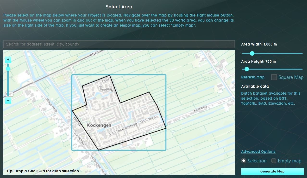
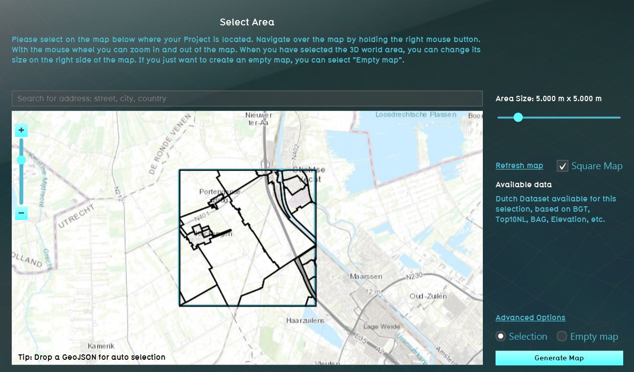
On the preview, it is possible to create a new project based on the bounding box of the features in a dataset. This makes it easier to select a project area based on exact coordinates instead of having to select the location by dragging the selection square/rectangle manually.
To select a project area based on a dataset, simply drag and drop a GeoJSON file with the features to the map. See the images below, the black outline is the GeoJSON data file and the blue square/rectangle the to be created new project.
Tygron support team