The Tygron Community Forum will be discontinued on March 6th 2026, matching the release of the 2026 version of the Tygron Platform.
Receive email notifications by changing your settings.
Click on your picture in the top right corner, go to Preferences and select your notification preferences.
Click on your picture in the top right corner, go to Preferences and select your notification preferences.
Thank you for contributing to our forum!
Please keep in mind:
1. To only comment on the topic where the discussion is about. Do you have a new question or topic? Please start a new discussion.
2. Be kind to other users!
Please keep in mind:
1. To only comment on the topic where the discussion is about. Do you have a new question or topic? Please start a new discussion.
2. Be kind to other users!
Groundwater at surface level

Dear support,
I have the following issue. For my project I lowered the terrein at a certain area. During my Groundwater event I let it rain and I was interested in the infiltration proces. At the specific area the groundwater lever rises above the surface level. And it doesn't look good. What could be the issue?
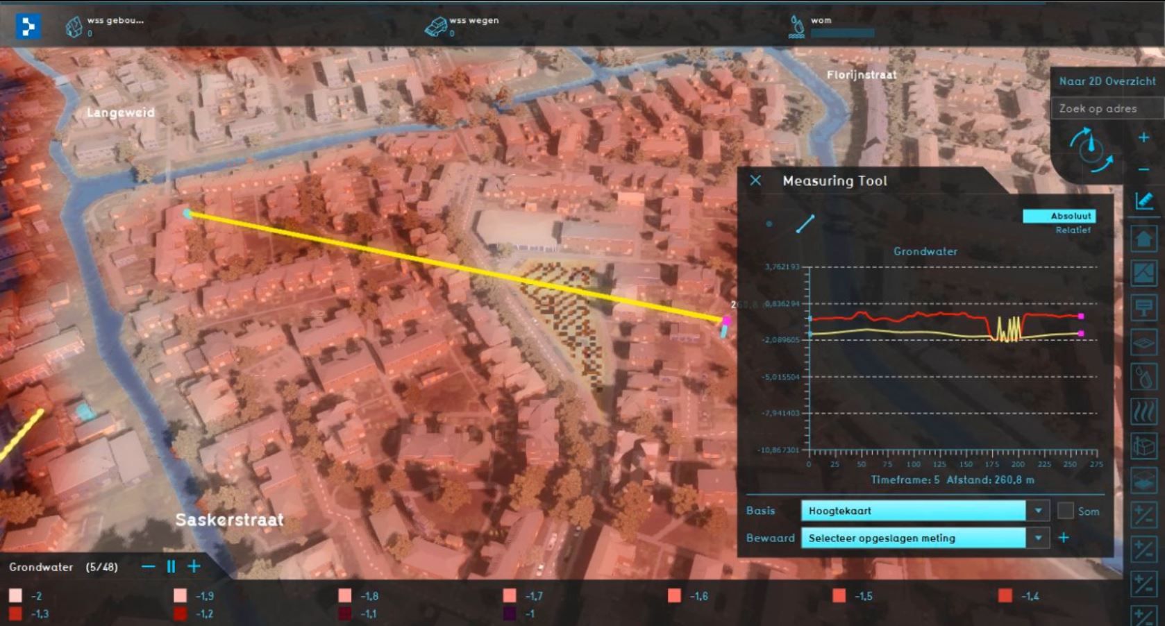
In the measuring tool the red line is the surface level. The yellow line is the groundwaterlevel. And the area in the middle of the picture is the area I lowered.
Comments
Hi Ward,
We will look into it and let you know what the issue could be!
Tygron support team
Hi Ward,
I think you have activated the GROUND_WATERTABLE, correct? What the table overlay does is take the groundwaterlevel or when it is very close to the surface the surfacewater level. The fluctuation that you see is NOT the groundwater level, but values very close to the threshold so it fluctuates between surface and groundlevels.
The reason that we combine surface and ground levels is so you can see the canal level flowing into the groundwater level. In this case the groundwater is almost below the canal, so this migth not be the best visualisation in this case.
What you can do to get the exact groundwater-only-level (in NAP) is take the SURFACE_ELEVATION and subtract GROUND_LAST_VALUE.
For future versions I will look into an "incude surface level"-checkbox in GROUND_WATERTABLE overlay. That way you can decide for yourself what's the best visualisation for the given project. Would that be useful?
Regards,
Maxim
Hi Ward,
On the Preview server (available for all customers at the start of January 2020 and released on the LTS server in the first quarter of 2020), this "incude surface level"-checkbox is added to the water overlay wizard:
For more information, see this Wiki page: https://previewsupport.tygron.com/wiki/Ground_watertable_with_surface_(Water_Overlay)
Tygron support team